


Our Services


Drones cannot fly in all weather conditions.
All scheduled flights are subject to changing weather conditions, including extreme wind, rain, and solar storms, and may need to be rescheduled at a moment's notice.
Packages

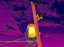
Thermal Inspection
-
Thermal Photo Inspection - Starting at $200 an hour
-
Thermal/RGB Orthomosaics - Starting at $500
-
Thermal inspections for electrical equipment, solar panels, and more
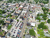
Real Estate Photography
-
20 Photo package - $300
-
Video Clip Add-On - $50 for 4 30-second unedited clips
-
Edited Video Add-On - Starting at $100 for 2-minute edited video
-
Orthomosaic Add-On - Starting at $100, includes a Digital Elevation Map
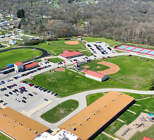
Event Coverage
-
Aerial Photo Coverage - Starting at $200 an hour for aerial photo coverage
-
Video + Photo Coverage - starting at $400 an hour
-
Coverage for any outdoor events, festivals, parades, fairs, parties, and more
-
Get a quote for multi-day events
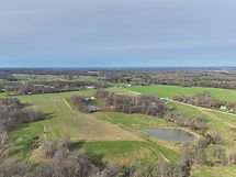
Orthomosaic Mapping
-
Basic Orthomosaic - Starting at $150, jobs will be priced based on required flight mission length and photo overlap due to complexity of the environment
-
Thermal Orthomosaic - Starting at $250
-
Digital Elevation Map Add-On - Available for $50
-
Google Earth style top-down maps

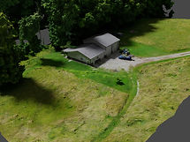
3D Photogrammetry Modeling
-
Pricing varies based on project size, detail level, and desired quality
-
Availability depends on the geometry of the building, vegetation, and surrounding area
-
Not all properties are well-suited for photogrammetry modeling

FAA Certified Drone Pilot
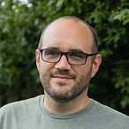
Our pilot, Tyler Lewellyn, is an FAA Part 107 Certified Remote Pilot, ensuring that all flights are conducted safely and legally. All flights are flown with liability insurance adjusted for each flight location. Enjoy peace of mind knowing that safety is our top priority.